


Ground and aerial photographs answer different questions about an industrial property. Ground views show entrances, visible building condition, loading areas, and interiors. Aerial views can show how buildings, parking, circulation areas, and the surrounding setting fit together.
The right combination depends on what a tenant, broker, or investor needs to understand about the specific site.
Begin with what is difficult to explain
Review the existing leasing materials. If a prospect cannot identify the correct entrance or see the available interior, add clear ground coverage. If a campus layout is hard to follow from separate exterior photos, an aerial overview may provide useful context.
Turn those gaps into requests: show the approach to Building B, photograph the available suite, or show the relationship between the buildings. A specific question produces a more useful brief than asking for a selection of drone shots.

The industrial photography checklist provides a complete brief. Explore photography, aerial drone coverage, and video production when deciding which deliverables answer your leasing questions.
Use both views when they add distinct information
Our Rice Creek Business Center I project includes daytime ground and aerial coverage in Shoreview, Minnesota. Our Airport Trade Center project includes leasing photography and video in Miami.
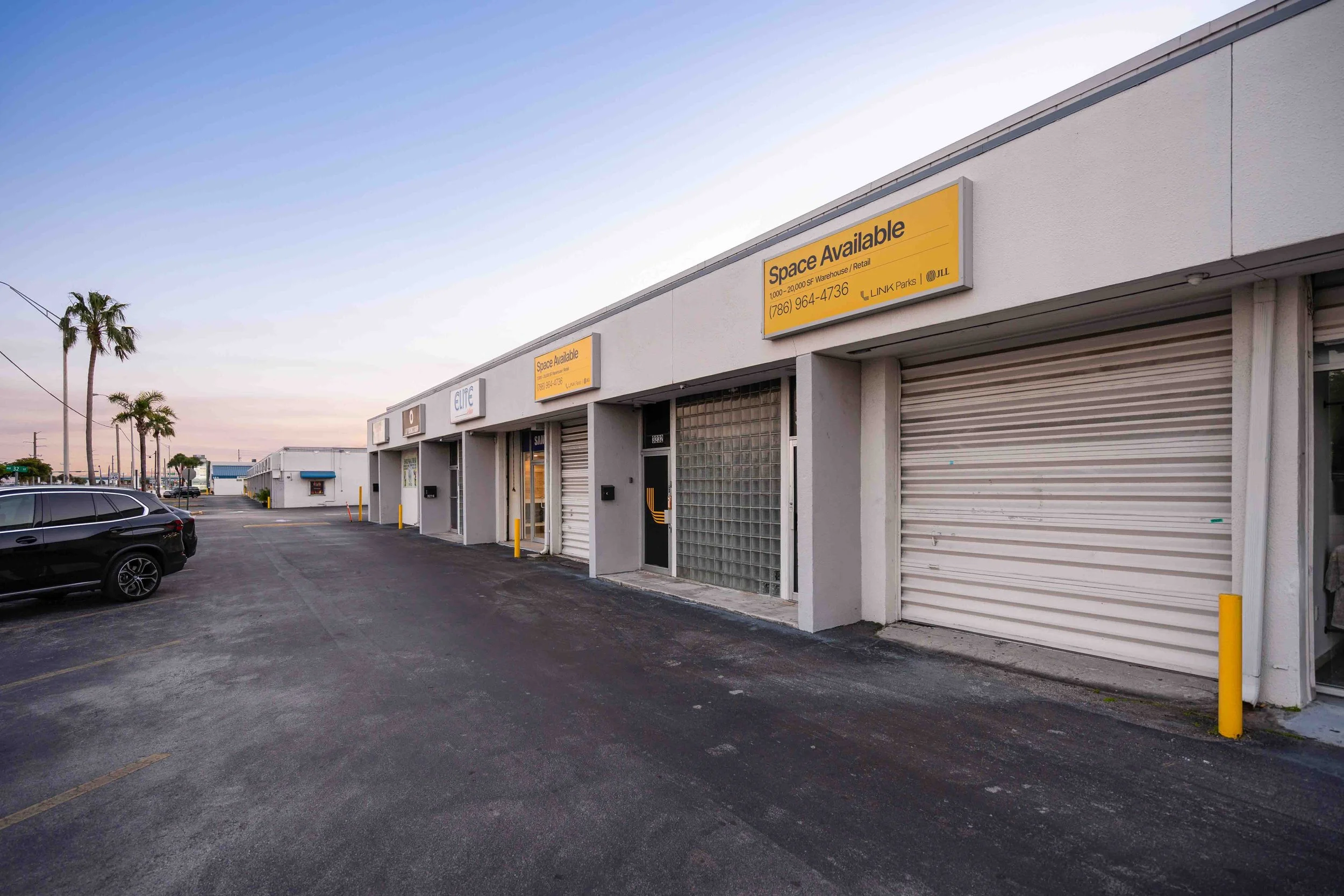
The Airport Trade Center entrance photograph gives a direct view into the property, with the monument signs and buildings on either side. An elevated site overview would serve a different purpose. It should be requested because that broader relationship matters to the assignment, rather than as a replacement for the arrival view.
Choose aerial angles that answer different questions
A straight-down view can make the arrangement of buildings, parking, and internal drives easier to read. At The Summit Business Park, the overhead photograph below shows several industrial buildings and the circulation space between them. It is useful visual context alongside an approved site plan; it is not a surveyed boundary or a measurement drawing.

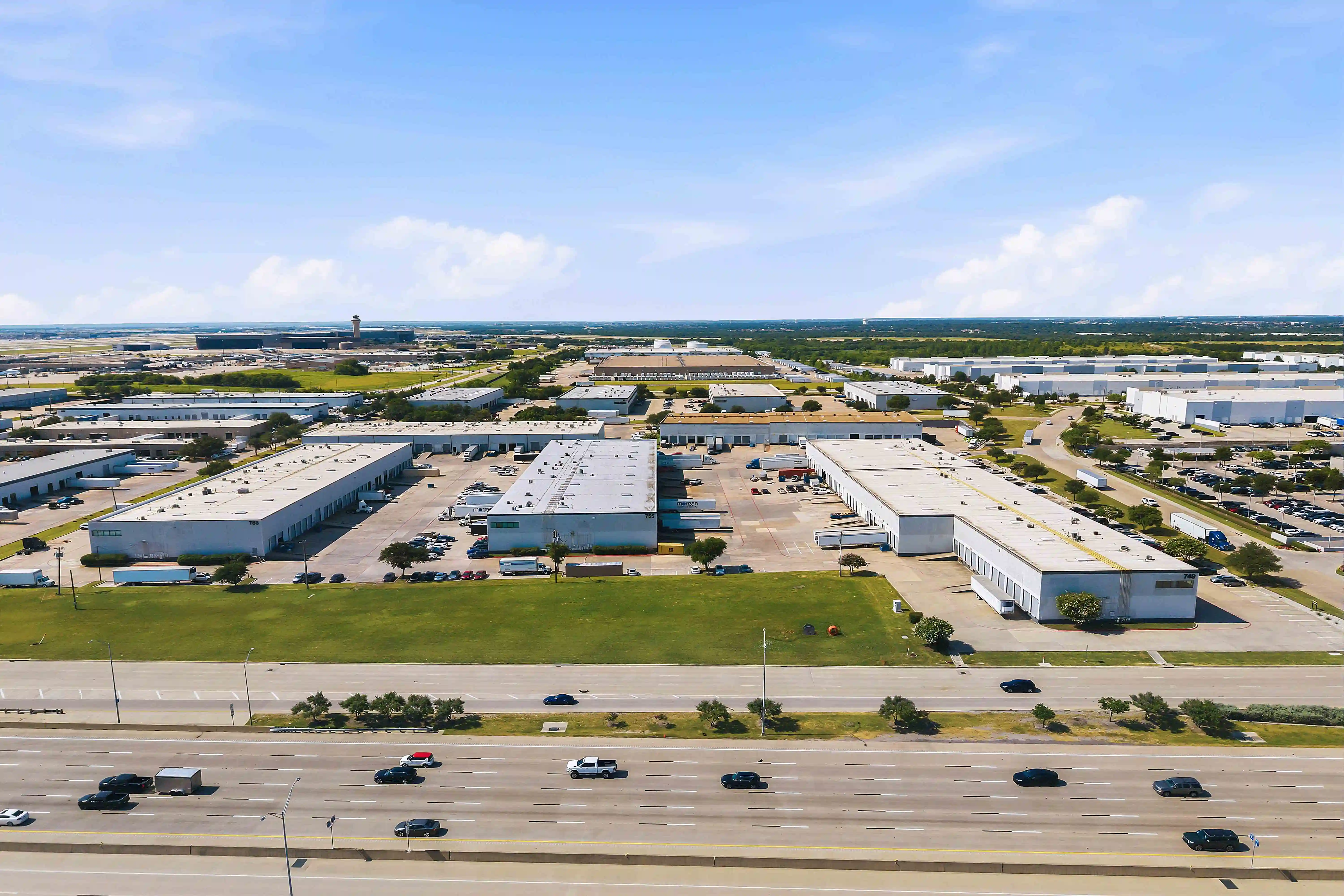
A wider oblique view adds the surrounding road network and adjacent development. Our Port America Industrial Park photograph places the warehouses beside the road in the foreground and shows the broader industrial setting. Use this kind of image to orient the viewer, then supply verified directions and property specifications separately.
A lower elevated view can connect the site overview with the ground-level experience. This second Rice Creek photograph makes the facade, landscaped frontage, parking, and bordering road easier to compare. Choosing several aerial positions is useful when each contributes new information. A sequence of nearly identical passes adds less value.
For the aerial portion of your brief, identify the primary building, the circulation areas to show, the surrounding context that matters, and whether a straight-down or oblique composition will explain it best. Keep proposed property outlines and labels subject to the owner's review.
Keep specifications separate from visual impressions
A wide view can make a loading area understandable, but it does not establish turning capacity, dimensions, or suitability for a particular operation. Supply approved measurements and site documents when those facts matter.
Apply the same discipline to location claims. An aerial image may show nearby roads, but drive times, routes, and distances need their own verification. If a map or overlay is part of the deliverable, agree on the source data and review the labels before release.
Planning a shoot? Send us your property, priority spaces, and deadline so we can recommend a deliverable-based scope.
Scope the coverage as a usable set
List the required ground views, intended aerial views, and any video separately. Confirm flight feasibility, access windows, the site's operating constraints, and the final formats. Identify the ground coverage that can still be completed if weather or access changes the aerial plan.
For multiple properties, keep the coverage categories consistent while allowing exceptions. A small flex building and a large industrial campus may need different images to answer the same leasing questions.
Explore our industrial and logistics portfolio for more project examples.
Plan coverage across the property list
For several locations, use the national production partner guide to organize vendor and coordination decisions. Review production FAQs before finalizing access and delivery requirements.
Send your addresses, existing images, and the site features prospects need to understand. Contact Clearform to plan ground and aerial coverage.


